Slightly pear-shaped: Measuring, Surveying and Mapping the World, part 2
That the Earth is round had been known for centuries; that it might also be (very) slightly oval was long-suspected, although we disagreed with the French as to which way the oval went.
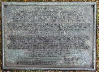
In this sequel to Jeremy’s talk last year, we look in more detail at the early British and French-led projects to create accurate maps and charts. In Britain, William Roy’s 1747 Survey of the Scottish Highlands would lead to the commencement, in 1791, of our nationwide Ordnance Survey. Meanwhile, the French had been busy with an even more ambitious project (begun in 1683) to measure their own prime meridian, not just through Paris and across France but around a quarter of the globe.
If points had been awarded for effort, their meridian would have prevailed over ours, but the unit they redefined in the process (originally the length of a seconds pendulum, but now intended to be one ten-millionth of the length they were measuring) is now — for better or worse — used around most of the world.
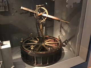
The Greenwich and Paris meridians were linked across the Channel in 1787 using rival surveying instruments, both accurate to one arc-second (one sixtieth of one sixtieth of a degree). Each side swore their design was better (you can still see one of ours, made by Jesse Ramsden, in the Science Museum) but both gave positioning errors of only 7 inches (oh, alright, 18 centimetres).
Plus: why NATO compasses are divided into 6,400 degrees and why, if you capture a Russian field gun, you really need to watch which way you point it.